第5章大西洋世界の形成Foundations of the Atlantic World
Introductionはじめに
Columbus Making Landfall.コロンブスの上陸。
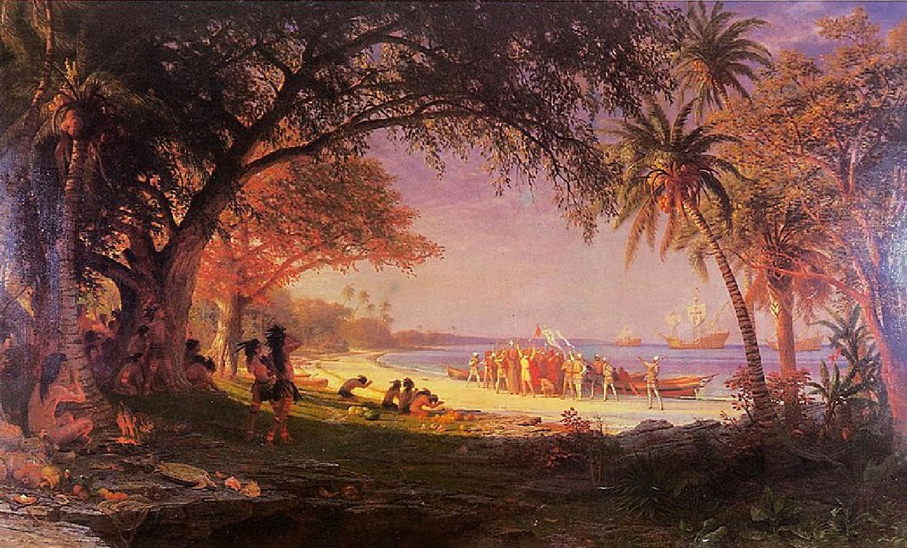
(credit: modification of work “The Landing of Columbus” by Albert Bierstadt/City of Plainfield, New Jersey/Wikimedia Commons, Public Domain) · Public Domain
Figure 5.1 This image of Christopher Columbus making landfall in the New World was painted by the German American artist Albert Bierstadt at the end of the nineteenth century. Ten feet long and six feet high, it presents Columbus in a romanticized fashion, with the Indigenous people bowing before him. They would likely have portrayed the event quite differently. (credit: modification of work “The Landing of Columbus” by Albert Bierstadt/City of Plainfield, New Jersey/Wikimedia Commons, Public Domain)
図5.1 クリストファー・コロンブスが新世界へ上陸するこの場面は、19世紀末にドイツ系アメリカ人画家アルバート・ビアスタットが描いた。幅10フィート、高さ6フィートの絵は、先住民がコロンブスの前で頭を下げる姿を描き、彼を美化している。先住民なら、おそらくこの出来事をまったく違った形で描いただろう。(クレジット:アルバート・ビアスタット/ニュージャージー州プレインフィールド市/Wikimedia Commons「コロンブスの上陸」を改変、パブリックドメイン)
The sixteenth century was a time of momentous change in Europe. The Age of Exploration began in the late 1400s with forays into the Atlantic by two European nations—Portugal and Spain. Although these countries took the lead and Christopher Columbus has been glorified as a central figure in the history of that exploration (Figure 5.1), they were soon joined by other European players including England, France, the Netherlands, and Denmark. Their extensive overseas exploration and the exploding web of connections in the Atlantic World—the Columbian Exchange, the colonization of the Americas, and the development of the Atlantic slave trade—forever changed people’s understanding of what the world was like and the face and direction of history. Yet far more was altered in the sixteenth century than the human conception of the earth; profound changes in European religious belief also transformed the way many Christians thought of the life they hoped for beyond this one.
英語のヒント
16世紀は、ヨーロッパにとって重大な変化の時代だった。大航海時代は1400年代末、ポルトガルとスペインという二つのヨーロッパ国家が大西洋へ進出したことで始まった。この二国が先頭に立ち、クリストファー・コロンブスはその探検史の中心人物として称揚されてきたが(図5.1)、まもなくイングランド、フランス、オランダ、デンマークなど、他のヨーロッパ勢力も加わった。大規模な海外探検と、急速に広がる大西洋世界のつながり――コロンブス交換、アメリカ大陸の植民地化、大西洋奴隷貿易の発展――は、世界がどのようなものかという人々の理解と、歴史の様相・方向を永久に変えた。しかし16世紀に変化したのは、人間の地球観だけではなかった。ヨーロッパの宗教信仰の深い変化も、多くのキリスト教徒が現世の先に望む来世をどう考えるかを一変させた。
Timeline: Foundations of the Atlantic World.年表:大西洋世界の基礎。
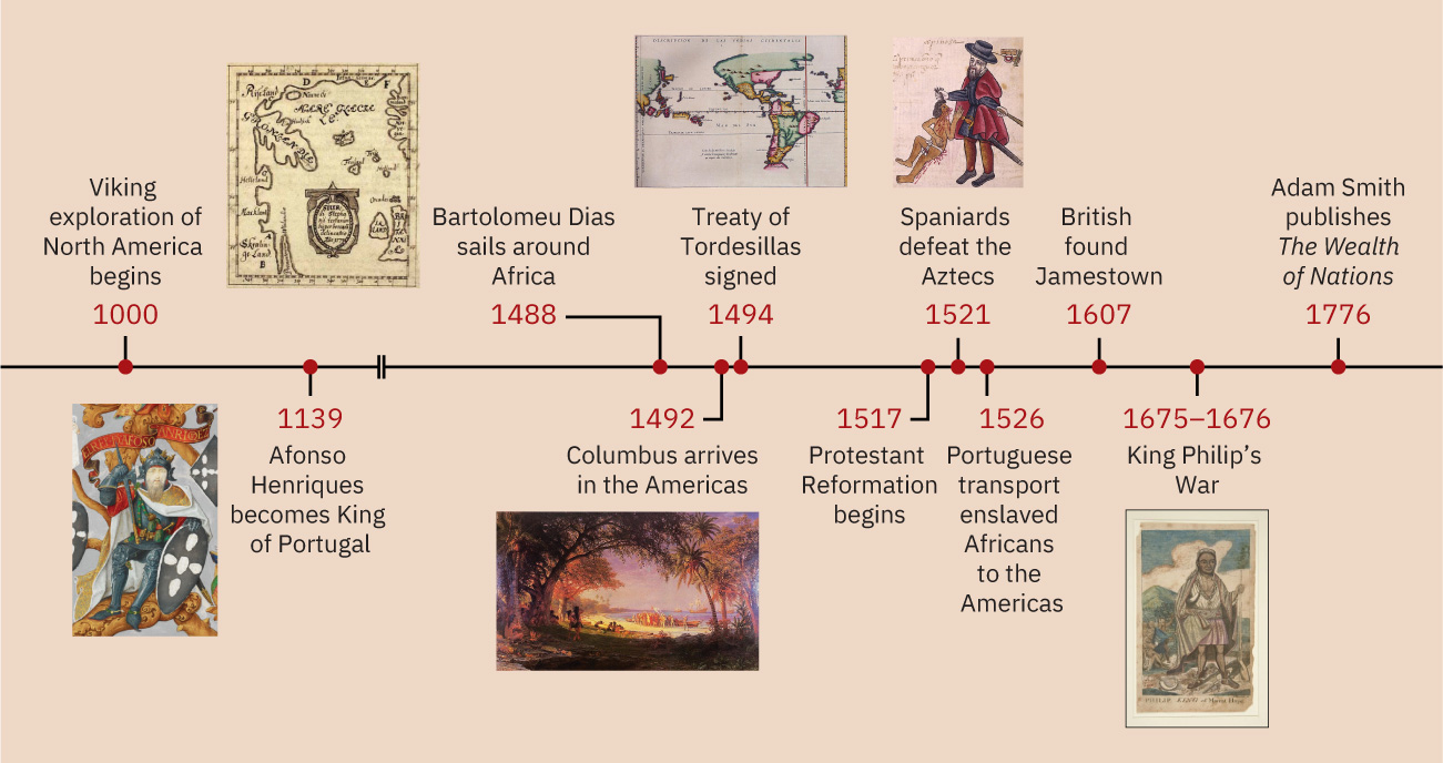
(credit “1000”: modification of work “Skálholt-map” by Sigurd Stefánsson/Wikimedia Commons, Public Domain; credit “1139”: modification of work “King Afonso Henriques, first King of Portugal, in a 16th century miniature” in The Portuguese Genealogy (Genealogia dos Reis de Portugal)/British Library/Wikimedia Commons, Public Domain; credit “1492”: modification of work “The Landing of Columbus” by Albert Bierstadt/City of Plainfield, New Jersey/Wikimedia Commons, Public Domain; credit “1494”: modification of work “Map of Meridian Line set under the Treaty of Tordesillas” by Library of Congress/Wikimedia Commons, Public Domain; credit “1521”: modification of work “An indigenous Mexican complaint against an abusive encomendero” by Codex Kingsborough/Wikimedia Commons, Public Domain; credit “1675–1676”: modification of work “Philip King of Mount Hope by Paul Revere” by Yale University Art Gallery/Wikimedia Commons, Public Domain) · Public Domain
Figure 5.2 (credit “1000”: modification of work “Skálholt-map” by Sigurd Stefánsson/Wikimedia Commons, Public Domain; credit “1139”: modification of work “King Afonso Henriques, first King of Portugal, in a 16th century miniature” in The Portuguese Genealogy (Genealogia dos Reis de Portugal)/British Library/Wikimedia Commons, Public Domain; credit “1492”: modification of work “The Landing of Columbus” by Albert Bierstadt/City of Plainfield, New Jersey/Wikimedia Commons, Public Domain; credit “1494”: modification of work “Map of Meridian Line set under the Treaty of Tordesillas” by Library of Congress/Wikimedia Commons, Public Domain; credit “1521”: modification of work “An indigenous Mexican complaint against an abusive encomendero” by Codex Kingsborough/Wikimedia Commons, Public Domain; credit “1675–1676”: modification of work “Philip King of Mount Hope by Paul Revere” by Yale University Art Gallery/Wikimedia Commons, Public Domain)
図5.2 (「1000年」:シグルズ・ステファーンソン/Wikimedia Commons「スカールホルト地図」を改変、パブリックドメイン。「1139年」:『ポルトガル王家の系譜』/大英図書館/Wikimedia Commons「16世紀の細密画に描かれたポルトガル初代王アフォンソ・エンリケス」を改変、パブリックドメイン。「1492年」:アルバート・ビアスタット/ニュージャージー州プレインフィールド市/Wikimedia Commons「コロンブスの上陸」を改変、パブリックドメイン。「1494年」:米国議会図書館/Wikimedia Commons「トルデシリャス条約で設定された子午線の地図」を改変、パブリックドメイン。「1521年」:『キングズバラ絵文書』/Wikimedia Commons「虐待するエンコメンデロに対するメキシコ先住民の訴え」を改変、パブリックドメイン。「1675〜1676年」:イェール大学美術館/Wikimedia Commons「ポール・リヴィアによるマウント・ホープのフィリップ王」を改変、パブリックドメイン)
Locator Map: Foundations of the Atlantic World.位置図:大西洋世界の基礎。
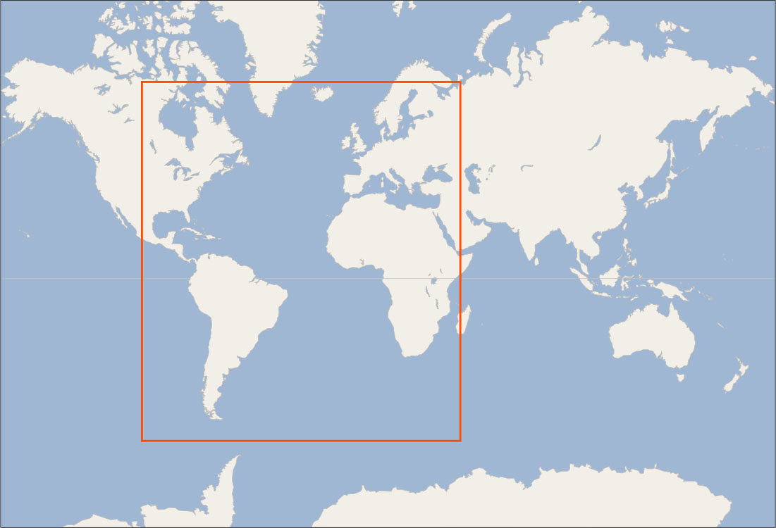
(credit: modification of work “World map blank shorelines” by Maciej Jaros/Wikimedia Commons, Public Domain) · Public Domain
Figure 5.3 (credit: modification of work “World map blank shorelines” by Maciej Jaros/Wikimedia Commons, Public Domain)
図5.3 (出典:原作品を加工:“World map blank shorelines”/Maciej Jaros/Wikimedia Commons、パブリックドメイン)