第3章近世アフリカと広域世界Early Modern Africa and the Wider World
Introductionはじめに
St. George of the Mine.サン・ジョルジェ・ダ・ミナ城
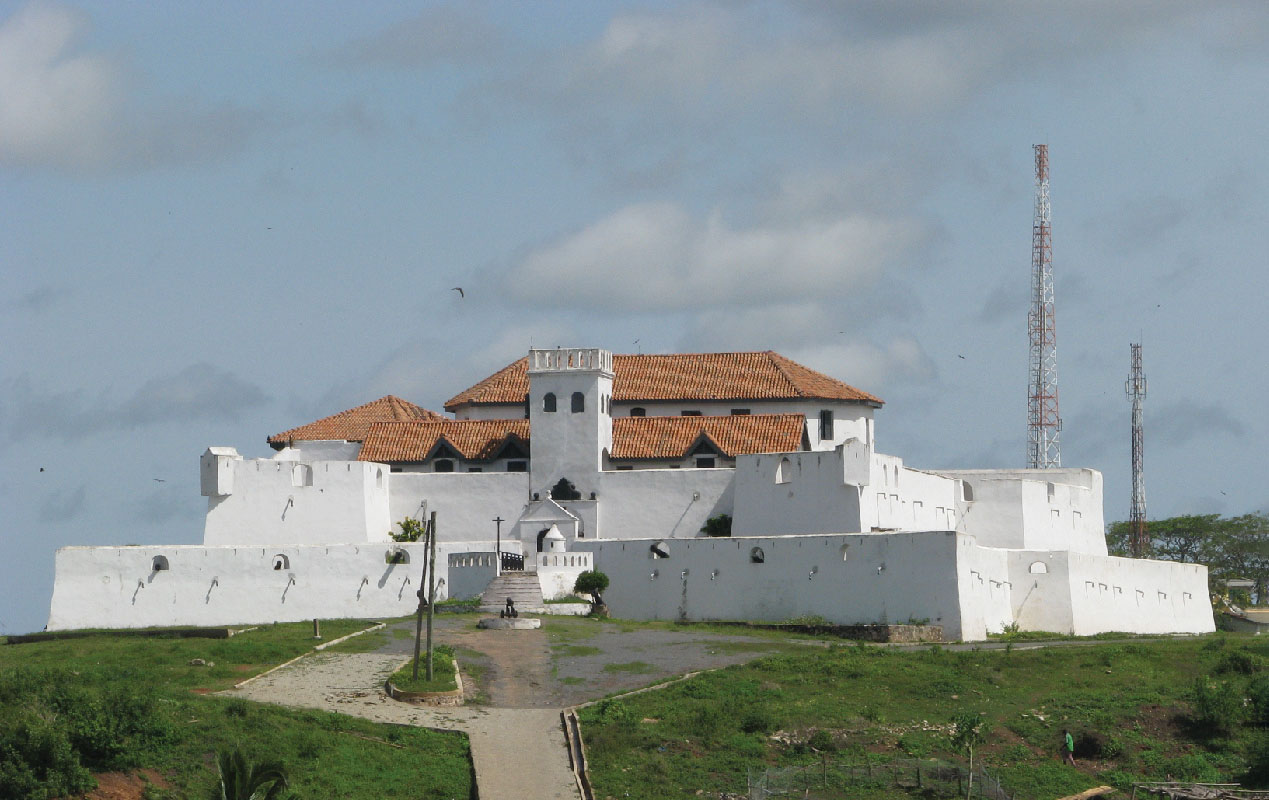
(credit: modification of work “St Jago fort in Elmina Ghana” by Edward Kamau/Wikimedia Commons, CC BY 3.0) · CC BY 3.0
Figure 3.1 The castle of St. George of the Mine overlooks the coast of Ghana. Built in the fifteenth century, it guarded Portugal’s trading post at El Mina. From here, the Portuguese traded for enslaved people brought from the interior of the African continent. (credit: modification of work “St Jago fort in Elmina Ghana” by Edward Kamau/Wikimedia Commons, CC BY 3.0)
図3.1 サン・ジョルジェ・ダ・ミナ城はガーナの海岸を見下ろしている。15世紀に築かれ、エルミナにあるポルトガルの交易拠点を守った。ポルトガル人はここで、アフリカ大陸の内陸から連れてこられた奴隷化された人々を取引した。(出典:Edward Kamau/Wikimedia Commons「St Jago fort in Elmina Ghana」を改変、CC BY 3.0)
The Portuguese built the castle of St. George of the Mine (later called Elmina) in the fifteenth century, which many historians characterize as the beginning of the early modern period (Figure 3.1). Located on the coast of present-day Ghana, the fortress gave the Portuguese a foothold in the West African gold trade, which was by then largely in the hands of the kingdom of Songhai (Songhay). The economic health and longevity of the Songhai Empire depended on the secure and smooth operation of the trans-Saharan trade in goods across North Africa. Gold was then unquestionably the most prized of all West African commodities, and in time, the trade in human cargo became equally important. With an eye toward their profit margins, the Portuguese traders at Elmina combined the flows of trade in these two highly valued commodities, becoming intermediaries who provided enslaved people from Benin to the Akan mines in modern-day Ghana and Côte d’Ivoire. By the sixteenth century, Elmina had become one of the earliest direct links between European slavers and the slave markets of the African interior.
英語のヒント
ポルトガル人は、多くの歴史家が近世の始まりとする15世紀に、サン・ジョルジェ・ダ・ミナ城(のちのエルミナ城)を築いた(図3.1)。現在のガーナの海岸に位置するこの要塞は、当時その大部分をソンガイ王国が握っていた西アフリカの金交易に、ポルトガル人が足場を築くことを可能にした。ソンガイ帝国の経済的な健全さと長期的な存続は、北アフリカを横断するサハラ交易が安全かつ円滑に運営されることに依存していた。当時、西アフリカの産物の中で最も高く評価されたものが金だったことは疑いない。やがて、人間を積荷として売買する交易も同じほど重要になった。エルミナのポルトガル商人は利益率に目を向け、この二つの高価な商品の交易の流れを結びつけ、ベニンから奴隷化された人々を、現在のガーナとコートジボワールにあるアカン人の鉱山へ供給する仲介者となった。16世紀までに、エルミナは、ヨーロッパの奴隷商人とアフリカ内陸の奴隷市場を直接結ぶ最初期の拠点の一つとなっていた。
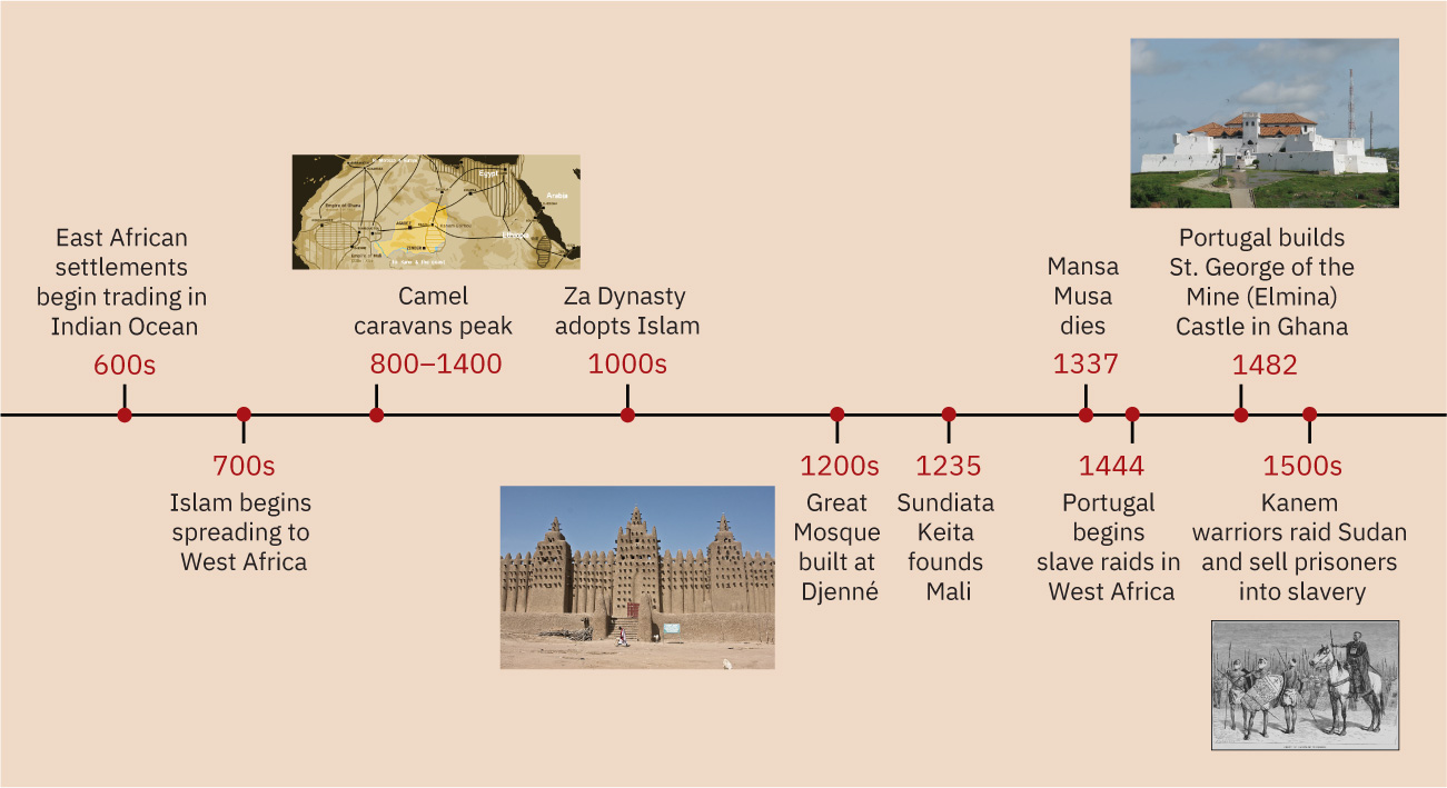
Timeline: Early Modern Africa and the Wider World.年表:近世アフリカと広域世界
(credit “800–1400”: modification of work “Map showing the main trans-Saharan caravan routes circa 1400” by T L Miles/Wikimedia Commons, Public Domain; credit “1200s”: modification of work “Great Mosque of Djenné” by JM/Flickr, CC BY 2.0; credit “1482”: modification of work “St Jago fort in Elmina Ghana” by Edward Kamau/Wikimedia Commons, CC BY 3.0; credit “1500s”: modification of work “Group of Kanem-Bu warriors” by New York Public Library Digital Gallery/Wikimedia Commons, Public Domain) · Public Domain + CC BY 2.0 + CC BY 3.0
Figure 3.2 (credit “800–1400”: modification of work “Map showing the main trans-Saharan caravan routes circa 1400” by T L Miles/Wikimedia Commons, Public Domain; credit “1200s”: modification of work “Great Mosque of Djenné” by JM/Flickr, CC BY 2.0; credit “1482”: modification of work “St Jago fort in Elmina Ghana” by Edward Kamau/Wikimedia Commons, CC BY 3.0; credit “1500s”: modification of work “Group of Kanem-Bu warriors” by New York Public Library Digital Gallery/Wikimedia Commons, Public Domain)
図3.2 (出典「800~1400年」:T L Miles/Wikimedia Commons「Map showing the main trans-Saharan caravan routes circa 1400」を改変、パブリックドメイン。「1200年代」:JM/Flickr「Great Mosque of Djenné」を改変、CC BY 2.0。「1482年」:Edward Kamau/Wikimedia Commons「St Jago fort in Elmina Ghana」を改変、CC BY 3.0。「1500年代」:New York Public Library Digital Gallery/Wikimedia Commons「Group of Kanem-Bu warriors」を改変、パブリックドメイン)
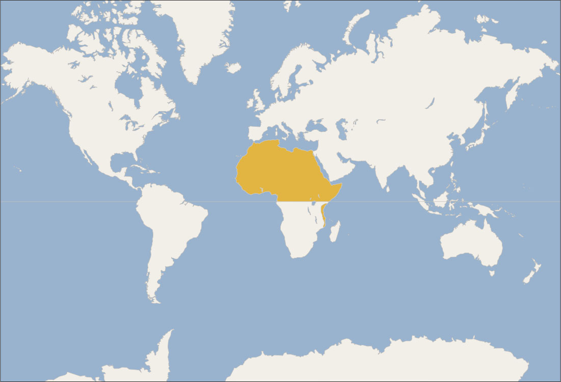
Locator Map: Early Modern Africa and the Wider World.位置図:近世アフリカと広域世界
(credit: modification of work “World map blank shorelines” by Maciej Jaros/Wikimedia Commons, Public Domain) · Public Domain
Figure 3.3 (credit: modification of work “World map blank shorelines” by Maciej Jaros/Wikimedia Commons, Public Domain)
図3.3 (出典:Maciej Jaros「World map blank shorelines」を改変、Wikimedia Commons、パブリックドメイン)