第4章イスラーム世界The Islamic World
Introductionはじめに
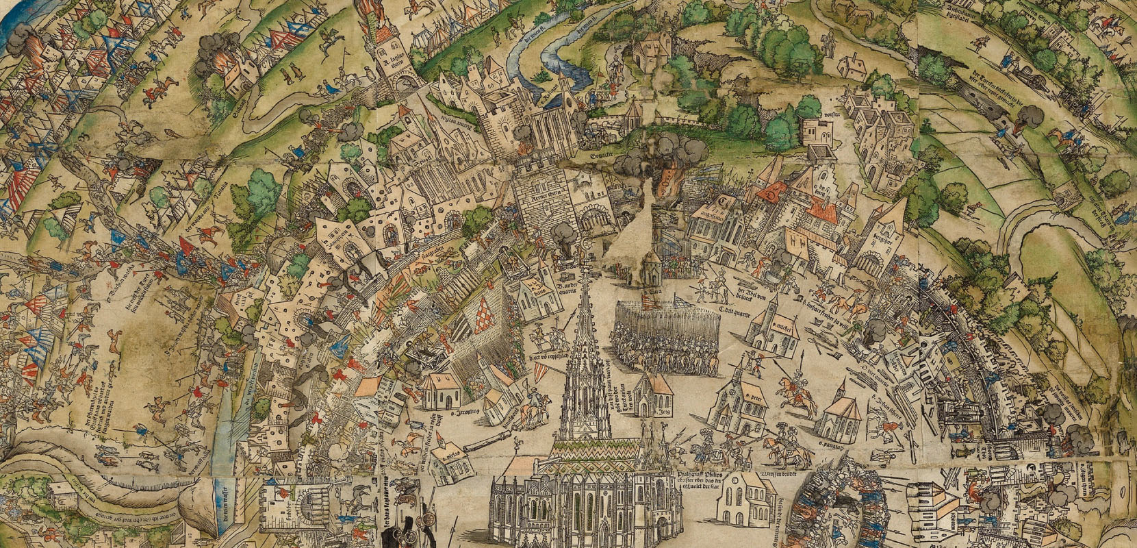
Vienna in 1529.1529年のウィーン。
(credit: modification of work “Panoramic view of Vienna during the first Turkish siege, 1529” by Vienna Museum/Wikimedia Commons, Public Domain) · Public Domain
Figure 4.1 Sultan Suleiman I’s attempted conquest of Vienna in 1529, the year before this panoramic map of the city was made, sent shockwaves across Europe. The building in the center of this detail view is St. Stephen’s Cathedral, which served as an informal headquarters for the defense of the city. (credit: modification of work “Panoramic view of Vienna during the first Turkish siege, 1529” by Vienna Museum/Wikimedia Commons, Public Domain)
図4.1 スルタン・スレイマン1世が1529年にウィーン征服を試みたことは、ヨーロッパ全体に衝撃を与えた。この都市の全景図は、その翌年に制作された。ここに示した部分の中央にある建物はシュテファン大聖堂で、都市防衛の非公式の司令部となった。(クレジット:ウィーン博物館/Wikimedia Commonsの「第一次トルコ軍包囲中のウィーン全景、1529年」を改変。パブリックドメイン)
In 1526, the Ottoman armies of Sultan Suleiman “the Magnificent” defeated the Hungarians at the Battle of Mohacs, setting the stage for a showdown with the Habsburgs, the rulers of Austria, at Vienna. In May 1529, Suleiman’s army of approximately 100,000 soldiers set out from the Black Sea through the spring rains for the culmination of Ottoman expansion into central Europe under his reign. Though somewhat weakened by the loss of equipment to heavier-than-expected rain, they reached the walls of Vienna in September and began the siege. Despite being greatly outnumbered, however, the Viennese defenders were able to repulse each of the Ottoman advances (Figure 4.1).
英語のヒント
1526年、「壮麗者」と呼ばれたスルタン・スレイマンのオスマン軍はモハーチの戦いでハンガリー軍を破り、オーストリアを支配するハプスブルク家とウィーンで対決する状況をつくった。1529年5月、約10万人の兵士からなるスレイマンの軍は黒海を発ち、春の雨の中を進んだ。この遠征は、彼の治世における中央ヨーロッパへのオスマン帝国の拡大を完成させるはずだった。予想以上の豪雨で装備を失い、多少戦力を弱められたものの、9月にはウィーンの城壁に到達し、包囲を始めた。しかしウィーンの守備隊は、兵力で大きく劣っていたにもかかわらず、オスマン軍の攻撃をそのたびに撃退することができた(図4.1)。
Eventually, Suleiman was forced to admit defeat and retreat to Constantinople, the former capital of the Byzantine Empire that was also commonly referred to as Istanbul (Greek for “to the city”). Although the 1529 siege of Vienna was a failure for the Ottomans, their bold move greatly alarmed kingdoms across Europe. It also led Suleiman to direct his attention east toward Iran and control of Mesopotamia, areas he thought more important for the security of his existing territory. By the end of his life in 1566, the Ottoman Empire was near the height of its power and territorial control. However, it was not the only large Muslim state to dominate Eurasia. The Safavids in Iran also expanded Islamic military, political, and economic power in the region we call the Middle East.
英語のヒント
結局スレイマンは敗北を認め、コンスタンティノープルへ撤退せざるを得なかった。ここはかつてビザンツ帝国の首都であり、一般にイスタンブルとも呼ばれていた。これはギリシア語で「都市へ」を意味する。1529年のウィーン包囲はオスマン軍の失敗に終わったが、その大胆な行動はヨーロッパ各地の王国を強く警戒させた。またスレイマンは、東のイランとメソポタミア支配に目を向けるようになった。彼はこれらの地域を、すでに保有している領土の安全にとってより重要だと考えたのである。彼が1566年に生涯を終えるころ、オスマン帝国の国力と領土支配は最盛期に近づいていた。しかし、ユーラシアに君臨する大きなムスリム国家は、この帝国だけではなかった。イランのサファヴィー朝も、私たちが中東と呼ぶ地域でイスラーム勢力の軍事力、政治力、経済力を拡大した。
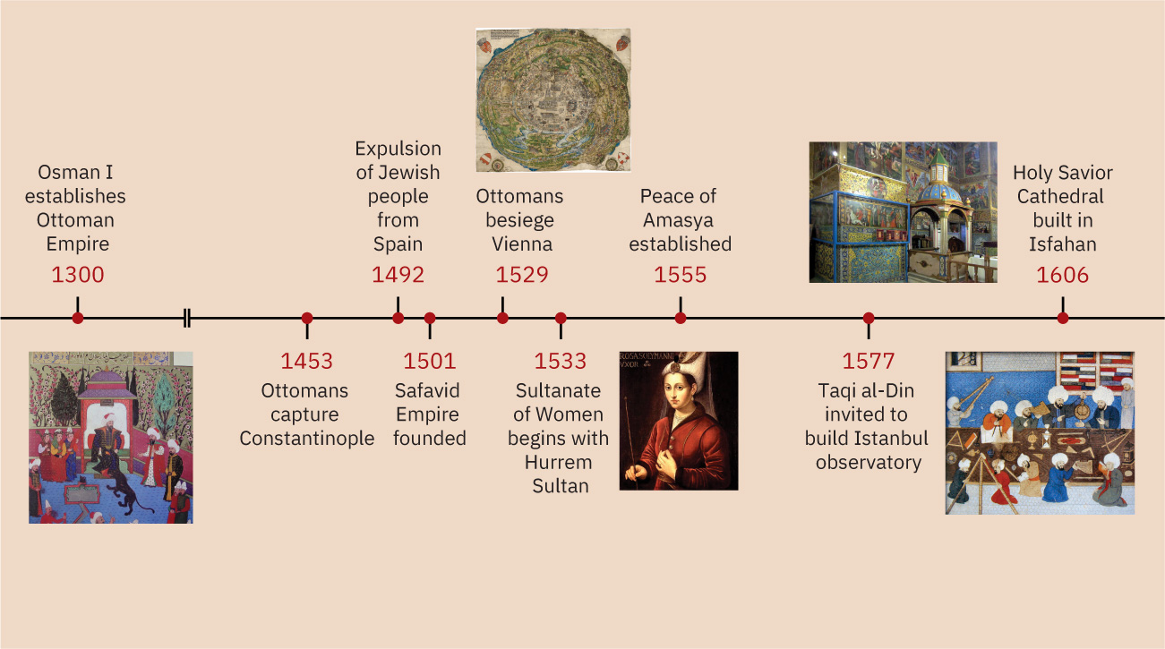
Timeline: The Islamic World.年表:イスラーム世界。
(credit “1300”: modification of work “Osman Gazi (I)” by Seyid Lockman/Wikimedia Commons, Public Domain; credit “1529”: modification of work “Panoramic view of Vienna during the first Turkish siege, 1529” by Vienna Museum/Wikimedia Commons, Public Domain; credit “1533”: modification of work “Portrait of Roxelana, Khourrem” by Jak Amran Collection, Istanbul/Wikimedia Commons, Public Domain; credit “1577” modification of work “Istambul observatory in 1577” by Cahiers de Science et Vie No114/Wikimedia Commons, Public Domain; credit “1606” modification of work “Armenian Frescoes” by David Stanley/Flickr, CC BY 2.0) · Public Domain + CC BY 2.0
Figure 4.2 (credit “1300”: modification of work “Osman Gazi (I)” by Seyid Lockman/Wikimedia Commons, Public Domain; credit “1529”: modification of work “Panoramic view of Vienna during the first Turkish siege, 1529” by Vienna Museum/Wikimedia Commons, Public Domain; credit “1533”: modification of work “Portrait of Roxelana, Khourrem” by Jak Amran Collection, Istanbul/Wikimedia Commons, Public Domain; credit “1577” modification of work “Istambul observatory in 1577” by Cahiers de Science et Vie No114/Wikimedia Commons, Public Domain; credit “1606” modification of work “Armenian Frescoes” by David Stanley/Flickr, CC BY 2.0)
図4.2 (「1300年」:セイイド・ロクマン/Wikimedia Commons「オスマン・ガーズィ1世」を改変、パブリックドメイン。「1529年」:ウィーン博物館/Wikimedia Commons「第一次トルコ軍包囲中のウィーン全景、1529年」を改変、パブリックドメイン。「1533年」:イスタンブルのジャック・アムラン・コレクション/Wikimedia Commons「ロクセラーナ、ヒュッレムの肖像」を改変、パブリックドメイン。「1577年」:Cahiers de Science et Vie 第114号/Wikimedia Commons「1577年のイスタンブル天文台」を改変、パブリックドメイン。「1606年」:デイヴィッド・スタンリー/Flickr「アルメニアのフレスコ画」を改変、CC BY 2.0)
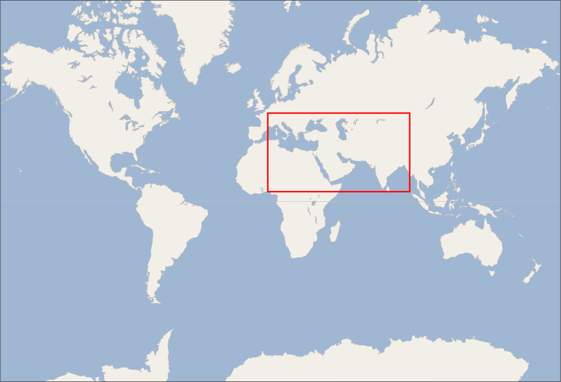
Locator Map: The Islamic World.位置図:イスラーム世界。
(credit: modification of work “World map blank shorelines” by Maciej Jaros/Wikimedia Commons, Public Domain) · Public Domain
Figure 4.3 (credit: modification of work “World map blank shorelines” by Maciej Jaros/Wikimedia Commons, Public Domain)
図4.3 (出典:Maciej Jaros/Wikimedia Commons「World map blank shorelines」を改変、パブリックドメイン)