第8章古代の南北アメリカThe Americas in Ancient Times
Introductionはじめに
Machu Picchu.マチュ・ピチュ
(credit: modification of work “Machu Picchu” by Roger Canals/Wikimedia Commons, CC0 1.0) · CC0 1.0
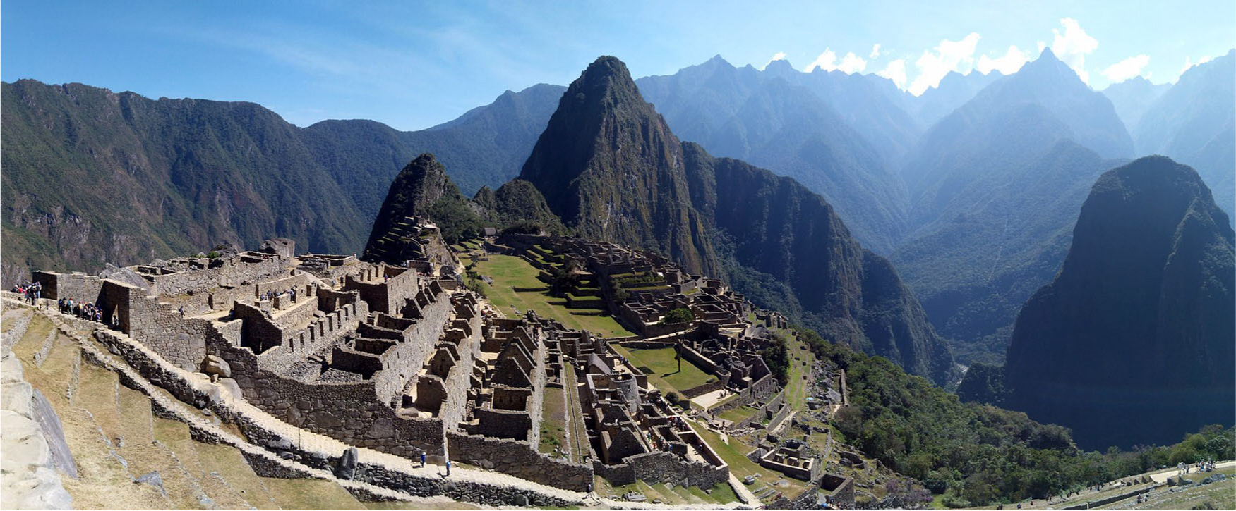
Figure 8.1 Nestled between two peaks high in the Andes Mountains, the Inca fortress of Machu Picchu was built in the fifteenth century CE and once looked out over an expansive empire. (credit: modification of work “Machu Picchu” by Roger Canals/Wikimedia Commons, CC0 1.0)
図8.1 アンデス山脈の高所、二つの峰の間に収まるインカの要塞マチュ・ピチュは、15世紀に建てられ、かつて広大な帝国を見渡していた。(出典:Roger Canals「Machu Picchu」を改変、Wikimedia Commons、CC0 1.0)
The stunning ruins of Machu Picchu, situated in the Andes Mountains between two sharp peaks almost eight thousand feet above sea level, continue to attract visitors from around the world (Figure 8.1). Once a palace and royal retreat for the conquering Inca ruler Pachacuti Yupanqui, the complex was begun in the mid-fifteenth century CE and remained occupied until shortly after the Spanish arrived in the following century. Under Pachacuti Yupanqui, from their Andean home city of Cuzco, the Inca extended their control and built a large empire in Peru. Later rulers continued this expansion, bringing much of western South America under their rule. While the Inca Empire was impressive and politically, religiously, and technologically sophisticated, it was merely the last of many Andean civilizations and cultures stretching back thousands of years. Indeed, these South American civilizations were part of an even larger number of cultures, empires, and architectural traditions that spanned the entire Western Hemisphere and were built by the descendants of migrants who reached the Americas several thousand years ago.
英語のヒント
アンデス山脈の鋭くそびえる二つの峰の間、海抜約8,000フィートに位置する壮麗なマチュ・ピチュの遺跡は、今も世界各地から訪れる人々を引きつけている(図8.1)。この建築群は、征服を進めたインカの支配者パチャクティ・ユパンキの宮殿兼王家の静養地だった。建設は15世紀半ばに始まり、翌世紀にスペイン人が到来してしばらくたつまで、人々が暮らしていた。パチャクティ・ユパンキのもと、インカはアンデスの本拠地クスコから支配を広げ、ペルーに大帝国を築いた。その後の支配者たちも拡張を続け、南アメリカ西部の大部分を支配下に収めた。インカ帝国は壮大で、政治・宗教・技術の面で高度に発達していたが、数千年にさかのぼるアンデスの数多くの文明や文化のうち、最後の一つにすぎなかった。実際、南アメリカのこれらの文明は、西半球全体に広がる、さらに多くの文化・帝国・建築の伝統の一部だった。それらを築いたのは、数千年前に南北アメリカへ到達した移住者たちの子孫である。
Timeline: The Americas in Ancient Times.年表――古代の南北アメリカ
(credit “11,000 BCE”: modification of work “Clovis point” by “Daderot”/Wikimedia Commons, CC0 1.0; credit “1200 BCE”: modification of work “An Olmec colossal head at the Xalapa Museum of Anthropology, in Veracruz, Mexico” by “Maunus”/Wikimedia Commons, Public Domain; credit “300 BCE”: modification of work “Maya stucco glyphs displayed in the museum at Palenque, Mexico” by “Kwamikagami”/Wikimedia Commons, Public Domain; credit “200 BCE”: modification of work “The Condor” by Roger Canals/Wikimedia Commons, CC0 1.0; credit “1000 CE”: modification of work “Chaco Canyon - Taaqa 'man' at Pueblo Bonita” by “Kyleson1”/Wikimedia Commons, CC BY 4.0; credit “1450 CE”: modification of work “Machu Picchu” by Roger Canals/Wikimedia Commons, CC0 1.0) · CC0 1.0 + Public Domain + CC BY 4.0
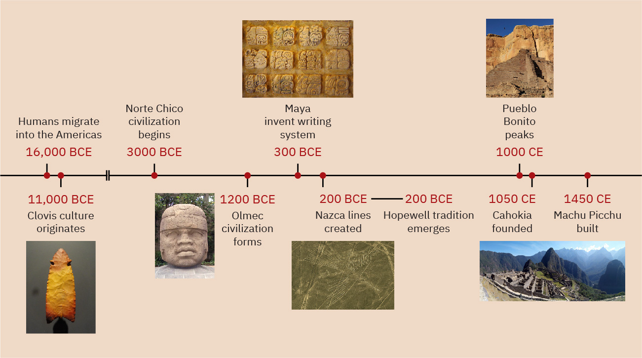
Figure 8.2 (credit “11,000 BCE”: modification of work “Clovis point” by “Daderot”/Wikimedia Commons, CC0 1.0; credit “1200 BCE”: modification of work “An Olmec colossal head at the Xalapa Museum of Anthropology, in Veracruz, Mexico” by “Maunus”/Wikimedia Commons, Public Domain; credit “300 BCE”: modification of work “Maya stucco glyphs displayed in the museum at Palenque, Mexico” by “Kwamikagami”/Wikimedia Commons, Public Domain; credit “200 BCE”: modification of work “The Condor” by Roger Canals/Wikimedia Commons, CC0 1.0; credit “1000 CE”: modification of work “Chaco Canyon - Taaqa 'man' at Pueblo Bonita” by “Kyleson1”/Wikimedia Commons, CC BY 4.0; credit “1450 CE”: modification of work “Machu Picchu” by Roger Canals/Wikimedia Commons, CC0 1.0)
図8.2 (出典「前11000年」:「Daderot」「Clovis point」を改変、Wikimedia Commons、CC0 1.0。出典「前1200年」:「Maunus」「An Olmec colossal head at the Xalapa Museum of Anthropology, in Veracruz, Mexico」を改変、Wikimedia Commons、パブリックドメイン。出典「前300年」:「Kwamikagami」「Maya stucco glyphs displayed in the museum at Palenque, Mexico」を改変、Wikimedia Commons、パブリックドメイン。出典「前200年」:Roger Canals「The Condor」を改変、Wikimedia Commons、CC0 1.0。出典「1000年」:「Kyleson1」「Chaco Canyon - Taaqa ‘man’ at Pueblo Bonita」を改変、Wikimedia Commons、CC BY 4.0。出典「1450年」:Roger Canals「Machu Picchu」を改変、Wikimedia Commons、CC0 1.0)
Locator Map: The Americas in Ancient Times.位置を確認する地図――古代の南北アメリカ
(credit: modification of work “World map blank shorelines” by Maciej Jaros/Wikimedia Commons, Public Domain) · Public Domain
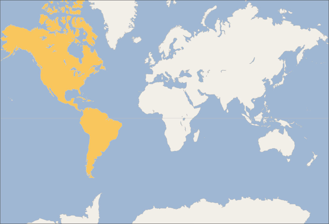
Figure 8.3 (credit: modification of work “World map blank shorelines” by Maciej Jaros/Wikimedia Commons, Public Domain)
図8.3 (出典:Maciej Jaros「World map blank shorelines」を改変、Wikimedia Commons、パブリックドメイン)