第15章サハラ以南のアフリカの国家と社会States and Societies in Sub-Saharan Africa
Introductionはじめに
Mansa Musa.マンサ・ムーサ
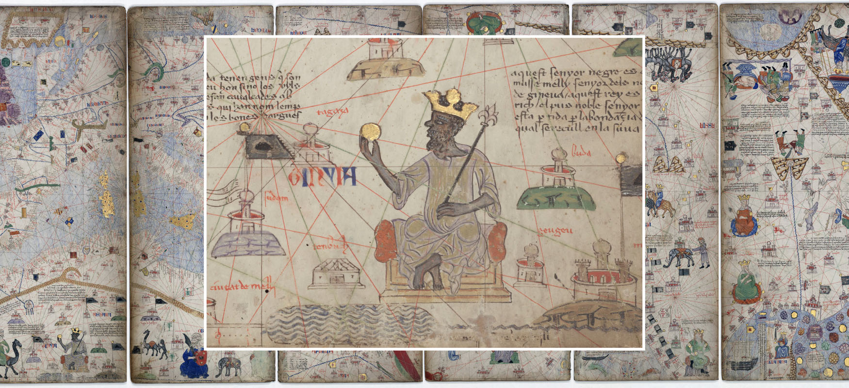
(credit background: modification of work “Catalan Atlas” by Bibliothèque Nationale de France/Wikimedia Commons, Public Domain; credit center: modification of work “Detail from the Catalan Atlas Sheet 6 showing Mansa Musa” by Gallica Digital Library/Wikimedia Commons, Public Domain) · Public Domain
Figure 15.1 This composite of images from the fourteenth-century Catalan Atlas depicts several pages of maps in the background, with a detail from the left-most page superimposed on top that shows the Malian king Mansa Musa enthroned, holding a golden scepter and orb and wearing a gold crown as symbols of his wealth and power. (credit background: modification of work “Catalan Atlas” by Bibliothèque Nationale de France/Wikimedia Commons, Public Domain; credit center: modification of work “Detail from the Catalan Atlas Sheet 6 showing Mansa Musa” by Gallica Digital Library/Wikimedia Commons, Public Domain)
図15.1 14世紀の『カタロニア地図帳』の画像を組み合わせたもの。背景には地図のページが並び、その上に、左端のページの一部を拡大して重ねている。マリ王マンサ・ムーサが玉座に座り、金の笏と宝珠を手に、金の王冠をかぶる。いずれも、富と権力の象徴である。(背景の出典:Bibliothèque Nationale de France/Wikimedia Commons「Catalan Atlas」を加工、パブリックドメイン。中央の出典:Gallica Digital Library/Wikimedia Commons「Detail from the Catalan Atlas Sheet 6 showing Mansa Musa」を加工、パブリックドメイン)
“[Quotation omitted for rights reasons.]” So wrote al-Umari of the fourteenth-century Malian king Mansa Musa. An official of the Mamluk Sultanate and Mansa Musa’s contemporary, al-Umari was in a unique position to describe the great Sudanic king of West Africa and his legendary wealth. At this time, Mansa Musa’s kingdom was the latest state in the history of West Africa to exploit its strategic location astride the trans-Saharan trade routes (Figure 15.1).
英語のヒント
〔権利の関係で割愛〕14世紀のマリ王マンサ・ムーサについて、アル=ウマリーは、このように記した。マムルーク朝の官僚であり、ムーサと同じ時代を生きたウマリーは、西アフリカのスーダーン地域の偉大な王と、その伝説的な富を述べるうえで、独特の立場にいた。当時、マンサ・ムーサの王国は、サハラ縦断交易路を押さえる戦略的な位置を利用して栄えた、西アフリカの国家の、最も新しい例だった(図15.1)。
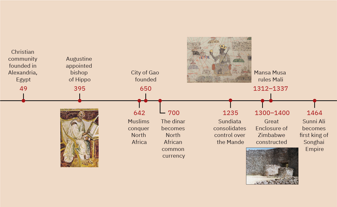
Timeline: States and Societies in Sub-Saharan Africa.年表:サハラ以南のアフリカの国家と社会
(credit “395”: modification of work “Augustine Lateran” by Unknown/Wikimedia Commons, Public Domain; credit “1312–1337”: modification of work “Detail from the Catalan Atlas Sheet 6 showing Mansa Musa” by Gallica Digital Library/Wikimedia Commons, Public Domain; credit “1300–1400”: modification of work “Great Zimbabwe, Main enclosure entrance” by “damien_farrell”/Flickr, CC BY 2.0) · Public Domain + CC BY 2.0
Figure 15.2 (credit “395”: modification of work “Augustine Lateran” by Unknown/Wikimedia Commons, Public Domain; credit “1312–1337”: modification of work “Detail from the Catalan Atlas Sheet 6 showing Mansa Musa” by Gallica Digital Library/Wikimedia Commons, Public Domain; credit “1300–1400”: modification of work “Great Zimbabwe, Main enclosure entrance” by “damien_farrell”/Flickr, CC BY 2.0)
図15.2 (「395年」の出典:作者不詳/Wikimedia Commons「Augustine Lateran」を加工、パブリックドメイン。「1312〜1337年」の出典:Gallica Digital Library/Wikimedia Commons「Detail from the Catalan Atlas Sheet 6 showing Mansa Musa」を加工、パブリックドメイン。「1300〜1400年」の出典:“damien_farrell”/Flickr「Great Zimbabwe, Main enclosure entrance」を加工、CC BY 2.0)
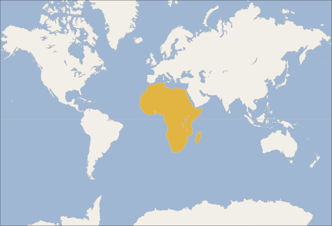
Locator Map: States and Societies in Sub-Saharan Africa.位置図:サハラ以南のアフリカの国家と社会
(credit: modification of work “World map blank shorelines” by Maciej Jaros/Wikimedia Commons, Public Domain) · Public Domain
Figure 15.3 (credit: modification of work “World map blank shorelines” by Maciej Jaros/Wikimedia Commons, Public Domain)
図15.3 (出典:Maciej Jaros/Wikimedia Commons「World map blank shorelines」を加工、パブリックドメイン)