第17章オスマン朝・マムルーク朝・明The Ottomans, the Mamluks, and the Ming
Introductionはじめに
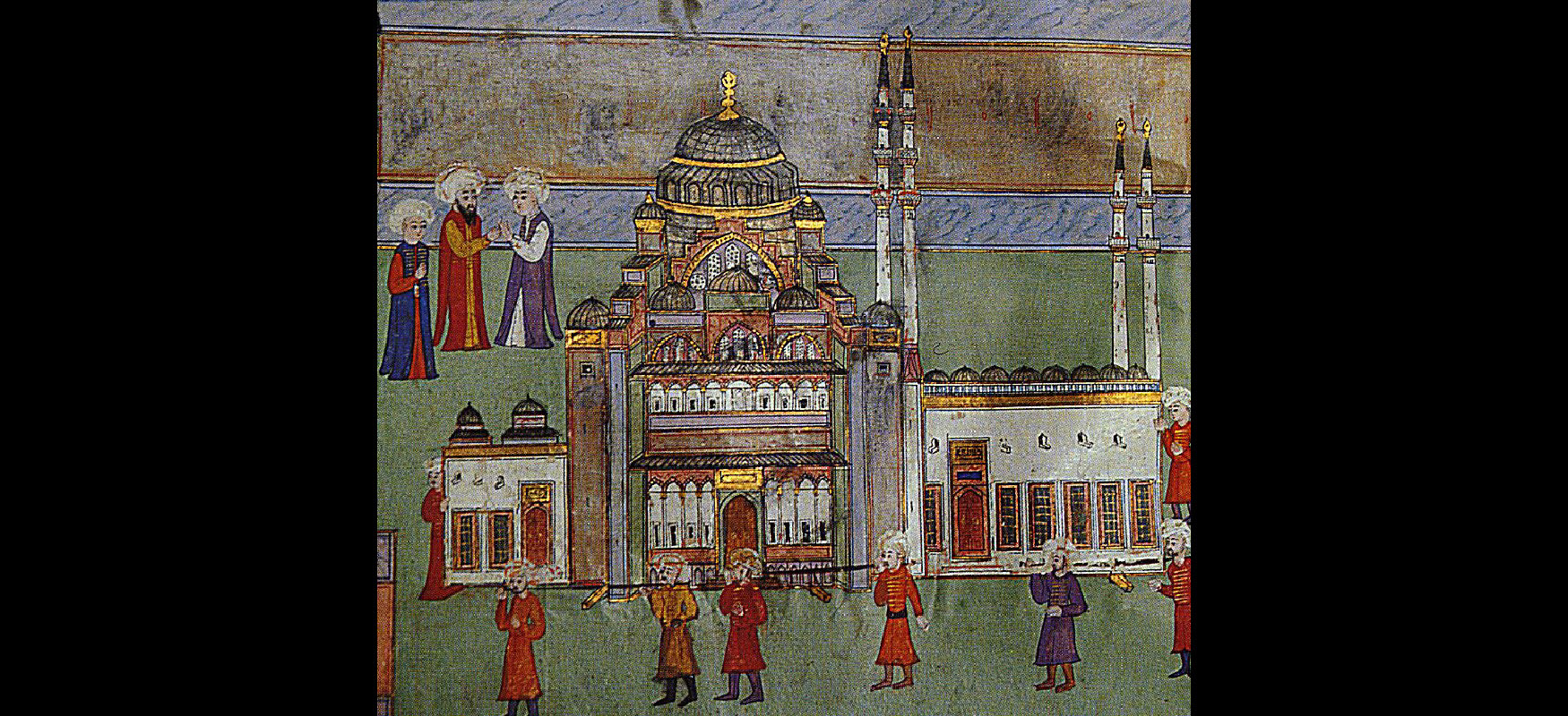
Suleymaniye Mosque.スレイマニエ・モスク。
(credit: modification of work “The carrying-in of a model of Süleymaniye Mosque (Detail from Surname-i Hümayun)” by Nakkaş Osman/Wikimedia Commons, Public Domain) · Public Domain
Figure 17.1 The Suleymaniye Mosque in Istanbul, depicted here in an Ottoman miniature, structurally resembles the Greek Orthodox church Hagia Sophia in the same city. The dome of the Süleymaniye Mosque rises about 53 metres above its floor, compared with about 55.6 metres at Hagia Sophia; the Süleymaniye Mosque also occupies a prominent hilltop site. (credit: modification of work “The carrying-in of a model of Süleymaniye Mosque (Detail from Surname-i Hümayun)” by Nakkaş Osman/Wikimedia Commons, Public Domain)
図17.1 オスマンの細密画に描かれたイスタンブルのスレイマニエ・モスクは、同市のギリシア正教会堂ハギア・ソフィアに、構造の面で似ている。スレイマニエ・モスクのドームは床から約53m、ハギア・ソフィアのドームは約55.6mである。スレイマニエ・モスクは、都市を見渡す丘の上という目立つ場所に建てられている。(出典: 原作品を加工:“The carrying-in of a model of Süleymaniye Mosque (Detail from Surname-i Hümayun)”/Nakkaş Osman/Wikimedia Commons, パブリックドメイン)
The Ottomans rose to prominence at the end of what historians call the Middle Ages and the beginning of the early modern period, arriving on the scene in the thirteenth century. In defeating the Byzantine Empire, the last remnant of ancient Rome, the Ottoman Empire became a gatekeeper between East and West, occupying a central position politically, economically, and culturally in Eurasia. The meeting of the two worlds is represented in the architecture of Istanbul’s Suleymaniye Mosque, which combines Islamic architectural elements such as minarets with a large central dome popularized in ancient Mediterranean temples and churches such as the Hagia Sophia in the same city (Figure 17.1). Hagia Sophia itself was transformed into a mosque by Mehmed the Conqueror when the city fell to Ottoman forces in 1453.
英語のヒント
オスマン勢力は13世紀に歴史の表舞台へ登場し、歴史家が中世の終わり、近世の始まりと呼ぶ頃に台頭した。古代ローマの最後の残存国家であったビザンツ帝国を破ったオスマン帝国は、東西の間を押さえる存在となり、ユーラシアの政治・経済・文化で中心的な位置を占めた。二つの世界の出会いは、イスタンブルのスレイマニエ・モスクの建築にも表れている。ミナレットなどイスラーム建築の要素と、古代地中海の神殿や教会で広まった大きな中央ドームを組み合わせている。同じ都市にあるハギア・ソフィアも、そのような建築の例である(図17.1)。ハギア・ソフィア自体も、1453年に都市がオスマン軍に落ちると、征服者メフメトによってモスクへと変えられた。
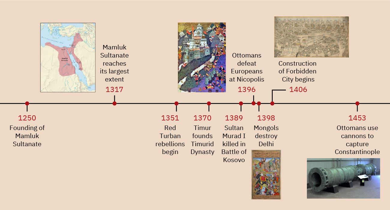
Timeline: The Ottomans, the Mamluks, and the Ming.年表:オスマン朝・マムルーク朝・明。
(credit "1317": Copyright Rice University, OpenStax, under CC BY 4.0 license; credit: “1396”: modification of work “Battle of Nicopolis, 1396” by Géza Fehér/Wikimedia Commons, Public Domain; credit “1398”: modification of work “Timur defeats the sultan of Delhi” by Zafarnama of Sharaf Al-Din ’Ali Yazdi/Wikimedia Commons, Public Domain; credit “1406”: modification of work “Ming shi san ling tu” by Arthur W. Hummel/Library of Congress, Geography and Map Division, Public Domain; credit “1453”: modification of work “Dardanelles Gun Turkish Bronze 15c” by “The Land”/Wikimedia Commons, Public Domain) · CC BY 4.0 + Public Domain
Figure 17.2 (credit "1317": Copyright Rice University, OpenStax, under CC BY 4.0 license; credit: “1396”: modification of work “Battle of Nicopolis, 1396” by Géza Fehér/Wikimedia Commons, Public Domain; credit “1398”: modification of work “Timur defeats the sultan of Delhi” by Zafarnama of Sharaf Al-Din ’Ali Yazdi/Wikimedia Commons, Public Domain; credit “1406”: modification of work “Ming shi san ling tu” by Arthur W. Hummel/Library of Congress, Geography and Map Division, Public Domain; credit “1453”: modification of work “Dardanelles Gun Turkish Bronze 15c” by “The Land”/Wikimedia Commons, Public Domain)
図17.2 (出典"1317": 著作権:Rice University, OpenStax/CC BY 4.0;出典: “1396”: 原作品を加工:“Battle of Nicopolis, 1396”/Géza Fehér/Wikimedia Commons, パブリックドメイン;出典 “1398”: 原作品を加工:“Timur defeats the sultan of Delhi”/Zafarnama of Sharaf Al-Din ’Ali Yazdi/Wikimedia Commons, パブリックドメイン;出典 “1406”: 原作品を加工:“Ming shi san ling tu”/Arthur W. Hummel/米国議会図書館・地理地図部, パブリックドメイン;出典 “1453”: 原作品を加工:“Dardanelles Gun Turkish Bronze 15c”/“The Land”/Wikimedia Commons, パブリックドメイン)
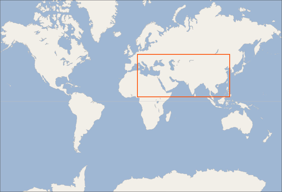
Locator Map: The Ottomans, the Mamluks, and the Ming.位置図:オスマン朝・マムルーク朝・明。
(credit: modification of work “World map blank shorelines” by Maciej Jaros/Wikimedia Commons, Public Domain) · Public Domain
Figure 17.3 (credit: modification of work “World map blank shorelines” by Maciej Jaros/Wikimedia Commons, Public Domain)
図17.3 (出典: 原作品を加工:“World map blank shorelines”/Maciej Jaros/Wikimedia Commons, パブリックドメイン)